Atlas of Russia
Specific status: Akrotiri and Dhekelia‡ · Faroe Islands · Gibraltar · Bailiwick of Guernsey · Isle of Man · Jersey · Svalbard – Limited recognition: Abkhazia‡ · Gagauzia · Kosovo · South Ossetia‡ · Transnistria · Northern Cyprus‡
‡: partly located in Europe

|
Wikimedia Commons Atlas of the World The Wikimedia Atlas of the World is an organized and commented collection of geographical, political and historical maps available at Wikimedia Commons. Discussion • Update the atlas • Index of the Atlas • Atlas in categories • Other atlases on line |
|
| ||||||||||||||||||||||||||||||||||||||||
General maps
_-_Crimea_disputed.svg/251px-Russian_Federation_(orthographic_projection)_-_Crimea_disputed.svg.png)
|
Russia |
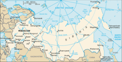
|
Map of Russia |
|
Blank SVG map |

|
SVG map in french |

|
Topographic map |
Maps of divisions
This section holds maps of the administrative divisions.
Federal subjects of the Russian Federation:
Republics: Adygea · Altai · Altai · Bashkortostan · Buryatia · Chechnya · Chuvashia · (Crimea) · Dagestan · Ingushetia · Kabardino-Balkaria · Kalmykia · Karachay–Cherkessia · Khakassia · Komi · Mari El · Mordovia · North Ossetia — Alania · Tatarstan · UdmurtiaKrais:
Oblasts:
Federal cities:
Autonomous oblast:
Autonomous okrugs:
.svg/251px-Map_of_federal_subjects_of_Russia_(2014).svg.png)
|
Federal subjects of theRussian Federation |

|
Federal districts of the Russian Federation |
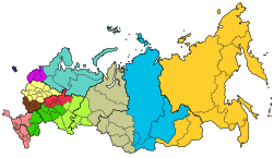
|
Economic regions of the Russian Federation |

|
Military districts of the Russian Federation |
Republics of Russia

|
Republics of the Russian Federation |
-
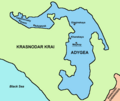
Map of Adygea(Республика Адыгея / Адыгэ Республик)
-
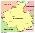
Altai
-
Map of Bashkortostan
-
Map of Buryatia
-
Map of Buryatia
-
Map of Chechnya
-
Map of Chuvashia (Чувашская Республика/Чăваш Республики)
-
Crimea
-
Crimea
-
Crimea
-
Map of Dagestan (Республика Дагестан)
-
Map of Ingushetia (Республика Ингушетия/ГIалгIай Мохк)
-
Map of Kabardino-Balkaria (Кабардино-Балкарская Республика/Къэбэрдей-Балъкъэр Республикэ/Къабарты-Малкъар Республика
-
Map of Kabardino-Balkaria (Кабардино-Балкарская Республика/Къэбэрдей-Балъкъэр Республикэ/Къабарты-Малкъар Республика
-
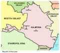
Map of Kalmykia (Республика Калмыкия/Хальмг Таңһч}
-
Map of Karachay-Cherkessia (Карачаево-Черкесская Республика/Къарачай-Черкес Республика/Къэрэшей-Шэрджэс Республикэ)
-
Map of Karelia
-
Map of Karelia (Республика Карелия/Karjalan Tazavalla)
-
Map of Karelia
-
Map of Karelia
-
Khakassia
-
Map of Komi (Республика Коми/Коми Республика}
-
Map of Mari El (Республика Марий Эл/Марий Эл Республика}
-
Map of Mordovia (Республика Мордовия/Мордовскяй Республикась)
-
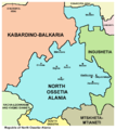
Map of North Ossetia-Alania (Республика Северная Осетия-Алания/Цӕгат Ирыстоны Аланийы Республикӕ)
-
Map of North Ossetia-Alania
-
Map of North Ossetia-Alania and wider Ossetia region
-
Sakha (Yakutia)
-
Map of Tatarstan (Республика Татарстан/Татарстан Республикасы )
-
Tuva
-
Map of Udmurtia (Удмуртская республика/Удмурт Элькун}
-
Map of Northern Caucasus
-
Map of Karachay-Cherkessia and Kabardino-Balkaria
-
Adygea
-
Altai
-
Buryatia
-
Chechnya
-
Chuvashia
-
Dagestan
-
Ingushetia
-
Kabardino-Balkaria
-
Kalmykia
-
Karachay-Cherkessia
-
Karelia
-
Khakassia
-
Komi
-
Mari El
-
Mordovia
-
North Ossetia-Alania
-
Sakha
-
Tatarstan
-
Tuva
-
Udmurtia
Autonomous Okrugs of Russia

|
Autonomuc Okrugs of the Russian Federation |
-
Chukotka
-
Chukotka
-
Khantia-Mansia
-
Khantia-Mansia
-
Nenetsia
-
Nenetsia
-
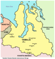
Yamalia
-
Yamalia
Krais of Russia

|
Krais of the Russian Federation |
-
Altai Krai
-
Khabarovsk Krai
-
Krasnodar Krai
-
Krasnoyarsk Krai
-
Perm Krai
-
Primorsky Krai
-
Stavropol Krai
Oblasts of Russia
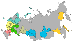
|
Русский: Области России English: Oblasts of the Russian Federation
|
-
Русский: Амурская областьEnglish: Amur Oblast
-
Русский: Архангельская областьEnglish: Arkhangelsk Oblast
-
Русский: Астраханская областьEnglish: Astrakhan Oblast
-
Русский: Белгородская областьEnglish: Belgorod Oblast
-
Русский: Брянская областьEnglish: Bryansk Oblast
-
Русский: Челябинская областьEnglish: Chelyabinsk Oblast
-
Русский: Читинская областьEnglish: Chita oblast
-
Русский: Иркутская областьEnglish: Irkutsk Oblast
-
Русский: Ивановская областьEnglish: Ivanovo Oblast
-
Русский: Калининградская областьEnglish: Kaliningrad Oblast
-
Русский: Калужская областьEnglish: Kaluga Oblast
-
Русский: Камчатская областьEnglish: Kamchatka Oblast
-
Русский: Кемеровская областьEnglish: Kemerovo Oblast
-
Русский: Кировская областьEnglish: Kirov Oblast
-
Русский: Костромская областьEnglish: Kostroma Oblast
-
Русский: Курганская областьEnglish: Kurgan Oblast
-
Русский: Курская областьEnglish: Kursk Oblast
-
Русский: Ленингра?дская о?бластьEnglish: Leningrad Oblast
-
Русский: Липецкая областьEnglish: Lipetsk Oblast
-
Русский: Магаданская областьEnglish: Magadan Oblast
-
Русский: Московская областьEnglish: Moscow Oblast
-
Русский: Мурманская областьEnglish: Murmansk Oblast
-
Русский: Нижегородская областьEnglish: Nizhny Novgorod Oblast
-
Русский: Новгородская областьEnglish: Novgorod Oblast
-
Русский: Новосибирская областьEnglish: Novosibirsk Oblast
-
Русский: Омская областьEnglish: Omsk Oblast
-
Русский: Оренбургская областьEnglish: Orenburg Oblast
-
Русский: Орловская областьEnglish: Oryol Oblast
-
Русский: Пензенская областьEnglish: Penza Oblast
-
Русский: Псковская областьEnglish: Pskov Oblast
-
Русский: Ростовская областьEnglish: Rostov Oblast
-
Русский: Рязанская областьEnglish: Ryazan Oblast
-
Русский: Сахалинская областьEnglish: Sakhalin Oblast
-
Русский: Самарская областьEnglish: Samara Oblast
-
Русский: Саратовская областьEnglish: Saratov Oblast
-
Русский: Смоленская областьEnglish: Smolensk Oblast
-
Русский: Свердловская областьEnglish: Sverdlovsk Oblast
-
Русский: Тамбовская областьEnglish: Tambov Oblast
-
Русский: Томская областьEnglish: Tomsk Oblast
-
Русский: Тверская областьEnglish: Tver Oblast
-
Русский: Тульская областьEnglish: Tula Oblast
-
Русский: Тюменская областьEnglish: Tyumen OblastEsperanto: Tjumenja provinco
-
Русский: Ульяновская областьEnglish: Ulyanovsk Oblast
-
Русский: Владимирская областьEnglish: Vladimir Oblast
-
Русский: Волгоградская областьEnglish: Volgograd Oblast
-
Русский: Вологодская областьEnglish: Vologda Oblast
-
Русский: Воронежская областьEnglish: Voronezh Oblast
-
Русский: Ярославская областьEnglish: Yaroslavl Oblast
Autonomous oblast of Russia

|
Autonomous oblast of the Russian Federation |
-
Русский: Еврейская автономная областьEnglish: Jewish Autonomous Oblast
-
Map of Jewish Autonomous Oblast
Raions of Russia
-
Русский: Респу́блика Адыге́я районEnglish: Administrative divisions of Adygea
-
Русский: Бря́нская о́бласть район
-
Русский: Смол́енская о́бласть район
-
Русский: Белгоро́дская о́бласть район
History maps
This section holds a short summary of the history of the area of present-day Russia, illustrated with maps, including historical maps of former countries and empires that included present-day Russia.
General history

|
Kurgan hypothesis: South Russia and Eastern Ukraine as the urheimat of Indo-European peoples |

|
Map of Scythia 100 BC |
|
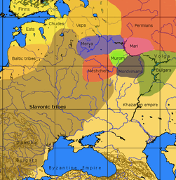
An approximative map of the cultures in European Russia at the arrival of the Varangians |
|
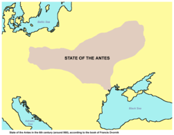
State of the Antes in the 6th century (around 560), according to the book of Francis Dvornik |
|
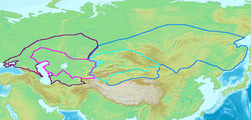
Map of the Western (purple) and Eastern (blue) Gokturk khaganates at their height, c. 600 CE. Lighter areas show direct rule; darker areas show spheres of influence. |
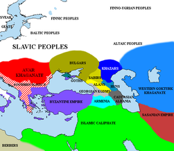
|
Development of Khazaria |

|
| [[|border|251x400px]] | Fall of Khazaria and rise of Kievan Rus |

|

|
Russia 9th-14th Century (Russian) |

|
Kievan Rus' was formed around 884 in an area that comprises now parts of Ukraine, Belarus and Russia. |

|

|
Early Rus' |

|
Varangian routes |

|
Kievan Rus 9th Century |

|
Kievan Rus 11th Century |

|
Kievan Rus 1015-1113(in Russian) |

|
Kievan Rus 1113-1194 (in Russian) |

|
Various states in Russia (in Russian) |

|
Various states in Russia around 1250 |
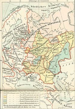
|
Development of Muscovy (in German) |

|
Development of Muscovy (in Russian) |

|
Russia 1598-1682 (Russian) |

|
Russia 1682-1762 (Russian) |

|
The Russian Empire in 1866 (including Alaska) |

|
The Russian Empire in 1914 |

|
History of the Russian Empire (in German) |
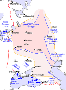
|
Russian Civil War |

|
Polish-Bolshevik War March 1919 |

|
December 1919 |

|
June 1920 |
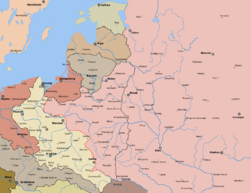
|
August 1920 |

|
Borders after treaty of Riga |

|
After the Russian Revolution, the former Russian Empire was continued by the Soviet Union. For more maps, see Atlas of the Soviet Union. Russia becomes a separate country again in 1990. |

|
Lokot Autonomy (Lokot Republic) map, 1941-1943 |
|
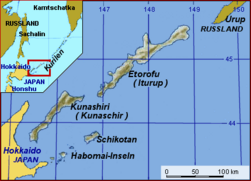
Kuril Islands conflict |
|
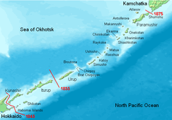
Kuril Islands |
Former autonomous subdivisions of Russia
-
Volga German ASSR, 1924-1941
-
Permyakia (Komi-Permyak Autonomous Okrug) until 2005
-
Aga Buryatia
-
Aga Buryatia
-
Koryakia
-
Koryakia
-
Ust-Orda Buryatia
-
Ust-Orda Buryatia
Old maps
This section holds copies of original general maps more than 70 years old.

|
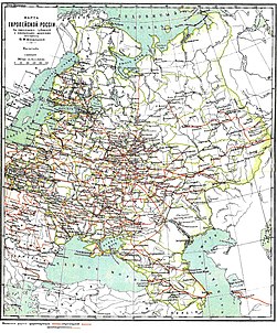
European Russia (in German) |
|
European Russia (in Russian) |

|
Ethnic map of European Russia (in French) |

|
Asiatic Russia (in Russian) |
Other maps

|
Russian language |
|
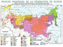
Indigenous peoples (in French) |

|
Time zones |

|
Russian licence plates |

|
Trans-Siberian railway |

|
Map of Russia in the colors of the Flag of Russia. |
-
Moscow - Central Okrug districts
-
Moscow - Eastern Okrug districts
-
Moscow - Northern Okrug districts
-
Moscow - North Eastern Okrug districts
-
Moscow - North Western Okrug districts
-
Moscow - Southern Okrug districts
-
Moscow - South Eastern Okrug districts
-
Moscow - South Western Okrug districts
-
Moscow - Western Okrug districts
-
City of Zelenograd districts
Notes and references
|
General remarks:
|
_-_RUS_-_UNOCHA.svg/200px-Russia_-_Location_Map_(2013)_-_RUS_-_UNOCHA.svg.png)

