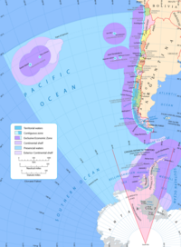
Atlas of Chile

From Wikimedia Commons, the free media repository
Jump to navigation Jump to search
Wikimedia Commons Atlas of the World

The Wikimedia Atlas of the World is an organized and commented collection of geographical, political and historical maps available at Wikimedia Commons.
Discussion • Update the atlas • Index of the Atlas • Atlas in categories • Other atlases on line
The introductions of the country, dependency and region entries are in the native languages and in English. The other introductions are in English.
 
Atlas-country
Chile


Chile

Español Chile - República de Chile

La República de Chile es un país ubicado en el extremo suroeste de América del Sur. Chile comprende una larga y estrecha franja de tierra conocida como Chile continental, entre el Océano Pacífico y la Cordillera de los Andes, que se extiende entre los 17º29'57'S y los 56º32'S de latitud (Islas Diego Ramírez), limitando al norte con Perú, al este con Bolivia y Argentina, y al sur con el Paso Drake. Además, posee territorios insulares en el Océano Pacífico, como el Archipiélago Juan Fernández y la Isla de Pascua (ubicada en la Polinesia), totalizando una superficie de 756.950 km². Por otra parte, Chile reclama soberanía sobre una zona de la Antártida de 1.250.000 km², denominada Territorio Chileno Antártico y comprendida entre los meridianos 90º y 53º Oeste prolongando su límite meridional hasta el Polo Sur. Esta reclamación está amparada de acuerdo a lo establecido por el Tratado Antártico. Debido a su presencia en Sudamérica, Oceanía y la Antártida, Chile se considera como un país tricontinental.Sitio Oficial de Chile- Esto es Chile

English Chile - Republic of Chile

The Republic of Chile is a country in South America occupying a long and narrow coastal strip wedged between the Andes mountains and the Pacific Ocean. The Pacific buttresses the country's entire western border, with ► Peru to the north, ► Bolivia to the northeast, ► Argentina to the east, and the Drake Passage at the country's southernmost tip, near to ► Antarctica Chile includes also the ► Easter Island. [[Atlas of Official Chile WebSite - This is Chile|► Official Chile WebSite - This is Chile]].


Short name  Chile
Official name Republic of Chile
Status Independent country since 1818 (Recognized since 1844)
Location South America
Capital Santiago de Chile
Population 19,458,310 inhabitants
Area 756,950 square kilometres (292,260 sq mi)
Major languages Spanish
Major religions Roman Catholicism
More information Chile, Geography of Chile, History of Chile and Politics of Chile
More images Chile - Chile (Category).

General maps

Map of Chile (in English)
Map of Chile (in Spanish)
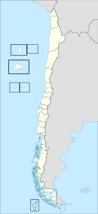
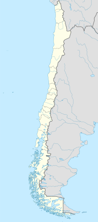
Location map of Chile

Mapas del Ministerio de Obras Públicas

Los mapas no son libres en el sentido de commons, pero pueden ser vistos en el sitio web del ministerio bajo:

(bajo el enlace "Descargar mapa cartera de proyectos")

Estan basados en datos de la NASA, SRTM, y muestran caminos, poblados, ríos, etc en muy buena resolución.

Mapas topográficos

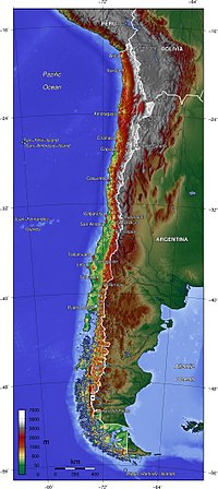
Mapa topografico de Chile
Map of Chile
Topographic map of Chile

Shuttle Radar Topography Mission

File:SRTM-W70.50E68.80S19.00N17.40.Arica.pngFile:SRTM-W70.50E68.34S20.00N19.00.Pisagua.pngFile:SRTM-W70.33E68.34S21.00N19.00.Iquique.pngFile:SRTM-W70.33E67.34S22.00N21.00.Quillagua.pngFile:SRTM-W70.50E67.00S23.00N22.00.Calama.pngFile:SRTM-S24.00N23.00W070.80E067.00.Antofagasta.pngFile:SRTM-W70.66E67.00S25.00N24.00.Paranal.pngFile:SRTM-W71.00E68.30S26.00N25.00.Taltal.pngFile:SRTM-W71.00E68.10S27.00N26.00.Salvador.pngFile:SRTM-W71.30E68.00S28.00N27.00.Copiapo.pngFile:SRTM-W71.60E69.20S29.00N28.00.Vallenar.pngFile:SRTM-W71.70E69.70S30.00N29.00.LaSerena.pngFile:SRTM-W71.90E69.70S31.00N30.00.Ovalle.pngFile:SRTM-W71.70E71.20S32.00N31.00.Illapel.pngFile:SRTM-W71.70E69.90S33.00N32.00.Quillota.pngFile:SRTM-W72.00E69.70S34.00N33.00.Talagante.pngFile:SRTM-W72.30E69.70S35.00N34.00.Chimbarongo.pngFile:SRTM-W73.00E70.00S36.00N35.00.Talca.pngFile:SRTM-W73.30E70.33S37.00N36.00.Chillan.pngFile:SRTM-W74.00E71.00S38.00N37.00.Nacimiento.pngFile:SRTM-W74.00E70.70S39.00N38.00.Temuco.pngFile:SRTM-W73.75E71.33S40.00N39.00.Valdivia.pngFile:SRTM-W74.00E71.50S41.00N40.00.Osorno.pngFile:SRTM-W74.20E71.70S42.00N41.00.PuertoMontt.pngFile:SRTM-W74.30E71.70S43.00N42.00.Chiloe.pngFile:SRTM-W75.00E71.50S44.00N43.00.Melinka.pngFile:SRTM-W75.00E71.00S45.00N44.00.Puyuguapi.pngFile:SRTM-W75.10E71.25S46.00N45.00.Coihaique.pngFile:SRTM-W75.80E71.50S47.00N46.00.Chilechico.pngFile:SRTM-W75.50E71.70S48.00N47.00.Cochrane.pngFile:SRTM-W75.90E72.00S49.00N48.00.VillaOHiggins.pngFile:SRTM-W75.90E72.00S50.00N49.00.PuertoEden.pngFile:SRTM-W75.66E72.00S51.00N50.00.IslaMadredeDios.pngFile:SRTM-W75.40E71.80S52.00N51.00.PuertoNatales.pngFile:SRTM-W75.10E68.33S53.00N52.00.PuntaDelgada.pngFile:SRTM-W74.50E68.33S54.00N53.00.PuntaArenas.pngFile:SRTM-W73.50E68.33S55.00N54.00.IslaNoir.pngFile:SRTM-W72.00E66.00S56.00N54.70.CanalBeagle.png

Castellano

Los mapas a que puedes acceder con un click sobre el mapa a la izquierda fueron generados con Generic Maping Tools (http://gmt.soest.hawaii.edu/archive copy at the Wayback Machine) y utilizan los registros topográficos de la Shuttle Radar Topography Mission (SRTM) (ftp://e0srp01u.ecs.nasa.gov/srtm/version2/SRTM3/[dead link]) que registran los cambios cada 3 segundos de grado, es decir cada 90 metros. La toponimia fue obtenida de http://earth-info.nga.mil/gns/html/cntry_files.html archive copy at the Wayback Machine y no es muy exacta. Clica sobre la imagen para abrir una imagen más detallada de cada zona.

Deutsch

Click auf die gewünschte Region auf der (linke) Chile-Karte um die topographische Karte zu bekommen. Die Landkarten sind mit Generic Maping Tools (http://gmt.soest.hawaii.edu/archive copy at the Wayback Machine) erstellt worden und sie verwenden die topographischen Daten aus Shuttle Radar Topography Mission (SRTM) (ftp://e0srp01u.ecs.nasa.gov/srtm/version2/SRTM3/[dead link]) die die Höhen jede 3 Sekunden gemessen haben, d.h. jede 90 m. Die Ortsnamen wurden aus http://earth-info.nga.mil/gns/html/cntry_files.html archive copy at the Wayback Machine geholt und sie sind nicht sehr exakt.

English

Click on the map at the left side to obtain topographic Maps generated with Generic Maping Tools (http://gmt.soest.hawaii.edu/archive copy at the Wayback Machine) and the topographic data from Shuttle Radar Topography Mission (SRTM) (ftp://e0srp01u.ecs.nasa.gov/srtm/version2/SRTM3/[dead link]) (90 m resolution). The toponymy is from http://earth-info.nga.mil/gns/html/cntry_files.html archive copy at the Wayback Machine, but it is not exact.

עברית

את המפות ניתן לגשת באמצעות לחץ על המפה שמאלה היו שנוצר עם Generic MapingTools(http://gmt.soest.hawaii.edu/archive copy at the Wayback Machine) ולהשתמש רשומות של theShuttle טופוגרפיות רדאר טופוגרפיהמיסיון (SRTM) (ftp://e0srp01u.ecs.nasa.gov/srtm/version2/SRTM3/[dead link]) כי שינויים שיא כל תואר של 3 שניות, כלומר כל 90 מטרים. שמות מקום נתקבלו http://earth-info.nga.mil/gns/html/cntry_files.html archive copy at the Wayback Machine ולא מאוד מדויק. לחץ על התמונה כדי לפתוח תמונה מפורטת יותר של כל אזור.

Ejemplo/Beispiel/Example (Ancho/Breite/Wide es/ist/is variable)
Region Pisagua
Region Temuco

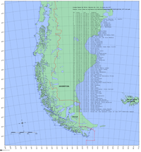
Joint Operations Graphics

Category:Joint Operations Graphic Chile

high resolution mapsFrontera triple (se19-6)Tacna, Arica, Caleta Vitor, hasta Frontera Chile-Bolivia (se19-10)Pisagua, Quebrada de CamaronesIquique, Huara, Pozo Almonte (sf19-02)Frontera Bolivia-Chile desde 20°S hasta 21°S: Salar de Coposa, Salar de la Laguna, Salar Laguani, Salar de Uyuni (parcialmente), Salar de Napa, Salar de Huasco, Cerro Piga, Cerro Paruma, Cerro HuaillaRío Loa, Quillagua (sf19-06)Frontera Chile-Bolivia (sf19-07)Tocopilla, Punta Hornos, Of. María Elena, Río Loa (sf19-10)Antofagasta (sf19-14)Antofagasta interior, Toconao, Peine, Tilomonte, Salar de Atacama (sf19-15)Punta Amarilla hasta Rada de Paposo ()Taltal, Chañaral, Parque Nacional Pan de Azúcar (sg19-05)Taltal, Of. Chile (sg19-06)Caldera, Río Copiapó (sg19-13)Carrizal Bajo, Huasco, Vallenar, Isla Choros (sh19-01)Isla Tilgo, La Serena, Coquimbo, Tongoy, Río Limarí (sh19-09)Frontera Chile-Argentina, Río Aconcagua, El Saladillo (si19-02)Bucalemu, Lago Vichuquén, Curepto, Constitución, Cauquenes (si18-16)San Carlos, Concepción, Chillán, San Ignacio, Bucupureo (sj18-04)Lago Nanalhue, Lebu, Coronel, Yungay, Los Angeles, Mulchén, Collipulli, Santa Bárbara, Quilaco (sj18-08)lago Lleulleu, Quidico, Tirúa, Lago Budi, Pitrufquén, Temuco, Lautaro, Victoria (sj18-12)Riñihue, Neltum, Choshuenco, Lago Villarrica, Gorbea, Loncoche, Valdivia (sj18-16)
Clicking on a yellow region in the picture causes the browser to load the appropriate high resolution map.

Castellano

Las Joint Operations Graphics son excelentes mapas en escala 1:250.000 editados por las fuerzas armadas de USA. Los mapas muestran relieve topográfico, vegetación, caminos, vías férreas, líneas de trasmisión de energía eléctrica, ciudades, pueblos, aldeas, líneas de telegráfo, divisiones administrativas, aeródromos, etc. Sin embargo, solo algunas regiones han sido publicadas. En la imagen, para casi todos los cuadrados amarillos se puede obtener un mapa con un click.

English

The Joint Operations Graphics are outstanding maps of some regions of Chile edited by the USA-Government. They show topography, vegetation, roads, railroads, power transmision lines, cities, telegraph lines, county borders, aerodrome, etc. For most of the yellow areas are maps available. You can access the map in scale 1:250.000 clicking the area.

Deutsch

Die Joint Operations Graphics sind herausragende Karten in Maßstab 1:250.000 die von der US-Streitkräfte veröffentlicht worden sind. Sie zeigen die Topographie, Vegetation, Landstraßen, Eisenbahnlinien, Hochspannungsleitungen, Städte, Dörfer, Telegraph-Linien, Verwaltungsgrenzen, usw. Leider sind nur wenige Regionen veröffentlicht worden. Für die meisten der gelben Rechtecken sind Karten mit einem Klick zu bekommen.

Ejemplo, Example, Beispiel

Zona de Arauco y la Cordillera de Nahuelbuta:

Mapas hidrográficos

Mapas de las cuencas hidrográficas de Chile pueden ser encontrados en Category:Maps of rivers of Chile (drainage basins BCN). Por ejemplo el mapa de la cuenca del es:Río Baker es el

Cuenca del río Baker.

Mapas de Enrique Espinoza

Es una serie de mapas publicados en 1903 que abarca desde Tacna hasta el Cabo de Hornos. Aunque no son muy detallados pueden ser usados para ubicar las ciudades, ríos y cerros mas importantes. Contiene ademas planos de Santiago, Valparaíso y planos de ramales ferroviarios, por ejemplo a Mendoza, Argentina.

Ver en Category:Maps of Chile by Enrique Espinoza

Mapa de la provincia de Ñuble
Plano de Valparaíso
Red ferroviaria de Chile

Mapas de Chile publicados en Guía Chile de Carlos Tornero 1903

Ver en Category:Mapas de Chile publicados en Guia Chile de Carlos Tornero 1903

Son seis mapas con bastante información, por ejemplo:

Mapa de Tacna, Arica, Tarapacá y Antofagasta

Mapas del Sur de Chile

Archipiélago de Chiloé

Archipiélago de los Chonos
Islas de Chile desde el Golfo de Penas hasta Puerto Natales

Estrecho de Magallanes
Islas de Chile desde el Golfo de Penas hasta Isla Diego de Almagro
Región de Aisen

Mapas de Pissis

en:Pedro José Amadeo Pissis produjo a mediados del siglo XIX un serie de mapas del territorio chileno. Los puedes encontrar en Category:Chile by Pissis

Mapas y dibujos de Claudio Gay

Una fuente inagotable de belleza e información se encuentra en la carpeta Category:Atlas de la historia física y política de Chile, que contiene imágenes creadas en 1854 por encargo del gobierno de Chile.

Por ejemplo la provincia de Cauquenes:

Cauquenes.


Mapas de Luis Risopatrón

Excelentes mapas publicados en 1910-1911 elaborados por Nicanor Boloña y Dañino, Luis Ossandón y Cressy, Luis Risopatrón. Contienen ríos, ciudades, pueblos, cadenas de montañas, líneas de ferrocarril y caminos. Algunas zonas al sur están marcadas como inexploradas. Los mapas se encuentran en:

Ejemplo:

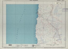
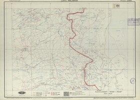
Mapas del Instituto Geográfico Militar de Chile, 1:250.000, década 1950

La colección es fabulosa, pero no están liberados todos los mapas. Ver Category:IGM-Chile. Ejemplo:

Iquique
Pica

Mapas del Instituto Geográfico Militar 1:500.000

Publicados el año 1945 con escala de 1:500.000, todas la regiones excepto la Antártica. Ejemplo:
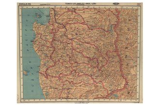
Temuco, Los Àngeles, Agol.

Pueden ser vistos (y utilizados) en:

Mapas étnicos

Pueblos indígenas de Chile

Mapas administrativos

Regions of Chile
Regions of Chile (in Spanish)
Provinces of Chile
Communes of Chile
En la categoría Category:SVG maps of Chile" encuentras, entre otros, mapas en formato SVG de cada comuna de Chile, por ejemplo, de la popular comuna de Conchalí de la ciudad de Santiago:

Under Category:SVG maps of Chile you may find, among others, SVG-maps of every 'comuna' in Chile, like e.g. the popular comune of Conchali in the city of Santiago:

Conchalí
Lineas de Base segun decreto oficial nr. 416 del 14 de junio de 1977.
Chile y su región antártica

Historia de Chile

Present-day Chile is originally populated by Arauca Indians and becomes partly under control of the Inca Empire.
Provinces of the Inca Empire
Major cultures in the Late intermediate period (1000-1400 CE). Some small parts of Chile are ruled by the Aymara Kingdoms.
Pachacuti-conquest.png
Tupac-inca-conquest.png
From 1536 to 1540 on major parts of the area are occupied by Spain and incorporated in the Vice-Royalty of Peru.

Under the name Captaincy-General of Chile the area becomes in 1778 a seperate dependency.
In 1810 Chile declares itself independent, but Spain recaptures Chile in 1814. In 1818 Chile finally gains independence in 1818 as the State of Chile, renamed Republic of Chile in 1826.

Old maps

This section holds copies of original general maps more than 70 years old.
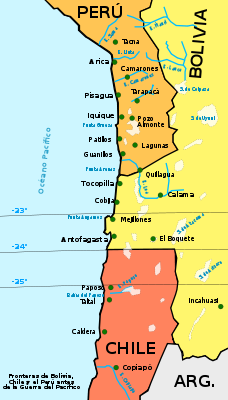
The War of the Pacific, sometimes called the Saltpeter War in reference to its original cause, was fought between Chile and the joint forces of Bolivia and Peru, from 1879 to 1884. Chile gained substantial mineral-rich territory in the conflict, annexing both the Peruvian province of Tarapacá and the Bolivian province of Litoral, leaving Bolivia as a landlocked country.
Chile in 1597 by Van Wytflyet, Leuven
Chile in 1635 by Jan Jansson, Amsterdam
Chile and the coast of South America, 1659
Chile in 1669 by Nicolas Sanson
The region in 1775 by D. Juan de la Cruz Cano y Olmedilla

Other maps

Vegetation map
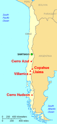
Major volcanoes in Chile
Density

Satellite maps

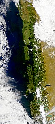
Satellite map

Notes and references

General remarks:

  • The WIKIMEDIA COMMONS Atlas of the World is an organized and commented collection of geographical, political and historical maps available at Wikimedia Commons. The main page is therefore the portal to maps and cartography on Wikimedia. That page contains links to entries by country, continent and by topic as well as general notes and references.
  • Every entry has an introduction section in English. If other languages are native and/or official in an entity, introductions in other languages are added in separate sections. The text of the introduction(s) is based on the content of the Wikipedia encyclopedia. For sources of the introduction see therefore the Wikipedia entries linked to. The same goes for the texts in the history sections.
  • Historical maps are included in the continent, country and dependency entries.
  • The status of various entities is disputed. See the content for the entities concerned.
  • The maps of former countries that are more or less continued by a present-day country or had a territory included in only one or two countries are included in the atlas of the present-day country. For example the Ottoman Empire can be found in the Atlas of Turkey.

Entries available in the atlas

General pages
Atlas   ■ Historical atlas   ■ Index of the Atlas   ■ Names in native languages

The world and its continents and oceans
Quick reference   ■ Historical maps of the world   ■ Old maps
Physical and topographical   ■ Political   ■ Geological   ■ People   ■ Time and time zones   ■ Projections of the globe
Africa   ■ North and South America   ■ Antarctica   ■ Asia   ■ Europe

(History, European Union)   ■ Oceania   ■ Oceans

Themes
Administrative divisions   ■ International organizations   ■ Languages   ■ Religions

Historical eras
Prehistory   ■ Antiquity   ■ Middle Ages   ■ Rise of Islam   ■ Early Modern Age   ■ Early American Societies   ■ Early Asian Societies   ■ Age of Renaissance   ■ Colonialism   ■ Stielers Handatlas 1891   ■ 20th Century   ■ World War I   ■ World War II

Entities with undisputed sovereign status
Afghanistan   ■ Albania   ■ Algeria   ■ Andorra   ■ Angola   ■ Antigua and Barbuda   ■ Argentina   ■ Armenia   ■ Australia   ■ Austria   ■ Azerbaijan   ■ Bahamas   ■ Bahrain   ■ Bangladesh   ■ Barbados   ■ Belarus   ■ Belgium   ■ Belize   ■ Benin   ■ Bhutan   ■ Bolivia   ■ Bosnia and Herzegovina   ■ Botswana   ■ Brazil   ■ Brunei   ■ Bulgaria   ■ Burkina Faso   ■ Burundi   ■ Cambodia   ■ Cameroon   ■ Canada   ■ Cape Verde   ■ Central African Republic   ■ Chad   ■ Chile   ■ China   ■ Colombia   ■ Comoros   ■ Congo (Democratic Republic)   ■ Congo (Republic)   ■ Costa Rica   ■ Côte d’Ivoire   ■ Croatia   ■ Cuba   ■ Cyprus   ■ Czech Republic   ■ Denmark   ■ Djibouti   ■ Dominica   ■ Dominican Republic   ■ East Timor   ■ Ecuador   ■ Egypt   ■ El Salvador   ■ Equatorial Guinea   ■ Eritrea   ■ Estonia   ■ Eswatini   ■ Ethiopia   ■ Fiji   ■ Finland   ■ France   ■ Gabon   ■ Gambia   ■ Georgia   ■ Germany   ■ Ghana   ■ Greece   ■ Grenada   ■ Guatemala   ■ Guinea   ■ Guinea-Bissau   ■ Guyana   ■ Haiti   ■ Honduras   ■ Hungary   ■ Iceland   ■ India   ■ Indonesia   ■ Iran   ■ Iraq   ■ Ireland   ■ Israel   ■ Italy   ■ Jamaica   ■ Japan   ■ Jordan   ■ Kazakhstan   ■ Kenya   ■ Kiribati   ■ Korea (Democratic People’s Republic)   ■ Korea (Republic)   ■ Kuwait   ■ Kyrgyzstan   ■ Laos   ■ Latvia   ■ Lebanon   ■ Lesotho   ■ Liberia   ■ Libya   ■ Liechtenstein   ■ Lithuania   ■ Luxembourg   ■ Madagascar   ■ Malawi   ■ Malaysia   ■ Maldives   ■ Mali   ■ Malta   ■ Marshall Islands   ■ Mauritania   ■ Mauritius   ■ Mexico   ■ Micronesia (Federated States)   ■ Moldova   ■ Monaco   ■ Mongolia   ■ Montenegro   ■ Morocco   ■ Mozambique   ■ Myanmar   ■ Namibia   ■ Nauru   ■ Nepal   ■ Netherlands   ■ New Zealand   ■ Nicaragua   ■ Niger   ■ Nigeria   ■ North Macedonia   ■ Norway   ■ Oman   ■ Pakistan   ■ Palau   ■ Panama   ■ Papua New Guinea   ■ Paraguay   ■ Peru   ■ Philippines   ■ Poland   ■ Portugal   ■ Qatar   ■ Romania   ■ Russia   ■ Rwanda   ■ Saint Kitts and Nevis   ■ Saint Lucia   ■ Saint Vincent and the Grenadines   ■ Samoa   ■ San Marino   ■ São Tomé and Príncipe   ■ Saudi Arabia   ■ Senegal   ■ Serbia   ■ Seychelles   ■ Sierra Leone   ■ Singapore   ■ Slovakia   ■ Slovenia   ■ Solomon Islands   ■ Somalia   ■ South Africa   ■ South Sudan   ■ Spain   ■ Sri Lanka   ■ Sudan   ■ Suriname   ■ Sweden   ■ Switzerland   ■ Syria   ■ Tajikistan   ■ Tanzania   ■ Thailand   ■ Togo   ■ Tonga   ■ Trinidad and Tobago   ■ Tunisia   ■ Turkey   ■ Turkmenistan   ■ Tuvalu   ■ Uganda   ■ Ukraine   ■ United Arab Emirates   ■ United Kingdom   ■ United States   ■ Uruguay   ■ Uzbekistan   ■ Vanuatu   ■ Vatican City   ■ Venezuela   ■ Vietnam   ■ Yemen   ■ Zambia   ■ Zimbabwe

Entities with disputed sovereign status
Abkhazia   ■ Artsakh   ■ Kosovo   ■ Northern Cyprus   ■ Palestine   ■ Somaliland   ■ South Ossetia   ■ Taiwan   ■ Tatarstan   ■ Transnistria   ■ Western Sahara

Dependencies and other overseas territories
Akrotiri and Dhekelia   ■ Åland   ■ American Samoa   ■ Anguilla   ■ Aruba   ■ Ascension Island   ■ Ashmore and Cartier Islands   ■ Baker Island   ■ Bermuda   ■ Bouvet Island   ■ British Indian Ocean Territory   ■ British Virgin Islands   ■ Cayman Islands   ■ Christmas Island   ■ Clipperton Island   ■ Cocos (Keeling) Islands   ■ Cook Islands   ■ Coral Sea Islands   ■ Curaçao   ■ Faroe Islands   ■ French Guiana   ■ French Polynesia   ■ French Southern and Antarctic Lands   ■ Gibraltar   ■ Greenland   ■ Guadeloupe   ■ Guam   ■ Guantanamo Bay   ■ Guernsey   ■ Heard Island and McDonald Islands   ■ Hong Kong   ■ Howland Island   ■ Isle of Man   ■ Jan Mayen   ■ Jarvis Island   ■ Jersey   ■ Johnston Atoll   ■ Kingman Reef   ■ Macau   ■ Martinique   ■ Mayotte   ■ Midway Atoll   ■ Montserrat   ■ Navassa Island   ■ New Caledonia   ■ Niue   ■ Norfolk Island   ■ Northern Mariana Islands   ■ Palmyra Atoll   ■ Pitcairn Islands   ■ Puerto Rico   ■ Réunion   ■ Saint Helena   ■ Saint Martin (France)   ■ Saint-Barthélemy   ■ Saint-Pierre and Miquelon   ■ Sint Maarten (Netherlands)   ■ Svalbard   ■ Tokelau   ■ Tristan da Cunha   ■ Turks and Caicos Islands   ■ United States Virgin Islands   ■ Wake Island   ■ Wallis and Futuna

Disputed subnational entities and territories
Bajo Nuevo Bank   ■ Crimea   ■ Falkland Islands   ■ Gilgit–Baltistan   ■ Kurdistan (Syrian)   ■ Kashmir   ■ Ladakh   ■ Paracel Islands   ■ Serranilla Bank   ■ South Georgia and South Sandwich Islands   ■ Spratly Islands   ■

Subnational autonomous entities
Aceh   ■ Adjara   ■ Adygea   ■ Altai   ■ Andalusia   ■ Aosta Valley   ■ Aragon   ■ Asturias   ■ Athos   ■ Azores   ■ Balearic Islands   ■ Bashkortostan   ■ Basque Autonomous Community   ■ Bonaire   ■ Bosnia and Herzegovina (Federation of)   ■ Bougainville   ■ Brussels   ■ Buryatia   ■ Canary Islands   ■ Catalonia   ■ Chechnya   ■ Chuvashia   ■ Corsica   ■ Dagestan   ■ Easter Island   ■ England   ■ Extremadura   ■ Flanders   ■ Friuli-Venezia Giulia   ■ Gagauzia   ■ Galicia   ■ Galápagos Islands   ■ Gilgit–Baltistan   ■ Gorno-Badakhshan   ■ Guangxi   ■ Ingushetia   ■ Islamabad Capital Territory   ■ Inner Mongolia   ■ Kabardino-Balkaria   ■ Kalmykia   ■ Karachay-Cherkessia   ■ Karakalpakstan   ■ Karelia   ■ Khakassia   ■ Komi   ■ Kurdistan (Iraqi)   ■ Khyber Pakhtunkhwa   ■ Madeira   ■ Mari El   ■ Muslim Mindanao   ■ Mordovia   ■ Nakhichevan   ■ Navarre   ■ Nevis   ■ Ningxia   ■ North Ossetia – Alania   ■ Northern Ireland   ■ Nunatsiavut   ■ Quebec   ■ Saba   ■ Sakha   ■ Sardinia   ■ Scotland   ■ Sicily   ■ Sindh   ■ Sint Eustatius   ■ Srpska   ■ Tibet   ■ Tłı̨chǫ   ■ Trentino-Alto Adige   ■ Tuva   ■ Udmurtia   ■ Vojvodina   ■ Wales   ■ Wallonia   ■ Xinjiang   ■ Zanzibar

Other regions
Basque Country   ■ Burzenland   ■ Catalan Countries   ■ Frisia   ■ Kurdistan   ■ Manchuria   ■ Sápmi   ■ Svenskfinland   ■ Székely Land   ■ Transylvania

Former sovereign nations
Austria-Hungary   ■ Byzantine Empire   ■ Caliphate   ■ Czechoslovakia   ■ Frankish Empire   ■ Kingdom of Hawaiʻi   ■ Inca Empire   ■ Iroquois Confederacy   ■ Macedonian Empire   ■ Ottoman Empire   ■ Prussia   ■ Roman Empire   ■ Soviet Union   ■ Republic of Texas   ■ Vermont Republic   ■ Republic of West Florida   ■ Yugoslavia

Former dependencies and overseas territories
Netherlands Antilles

Former disputed territories
Tamil Eelam